
Our BIM (Building Information Modeling) services represent the cutting edge in the management and development of construction and architectural design projects. We specialize in the creation and administration of information models for buildings and infrastructure.
BIM enables the creation of detailed three-dimensional digital models, facilitating a complete understanding of the project before its physical construction. This visualization helps identify potential design problems or conflicts, allowing for proactive solutions.
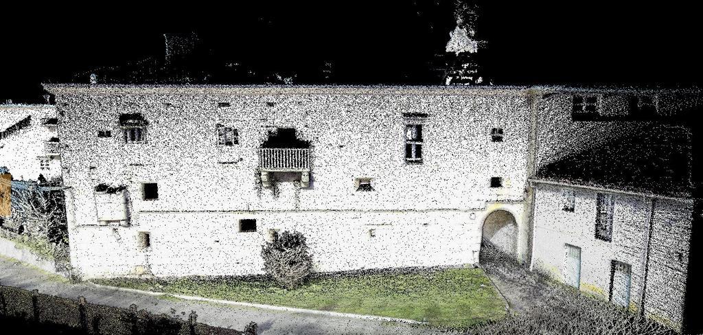
A 3D point cloud is the first product resulting from laser scanning. The result of the scan is a digital twin, that is, in this case, a 3-dimensional digital representation of a building or monument. This digital representation is made up of millions of points positioned three-dimensionally in space, which offers the possibility of measuring distances and angles between different points. The main objective of obtaining a 3D point cloud is to facilitate the work of companies in different sectors, as well as obtain quick products, reduce costs, reduce project preparation times and obtain better quality results, with a high level of detail.
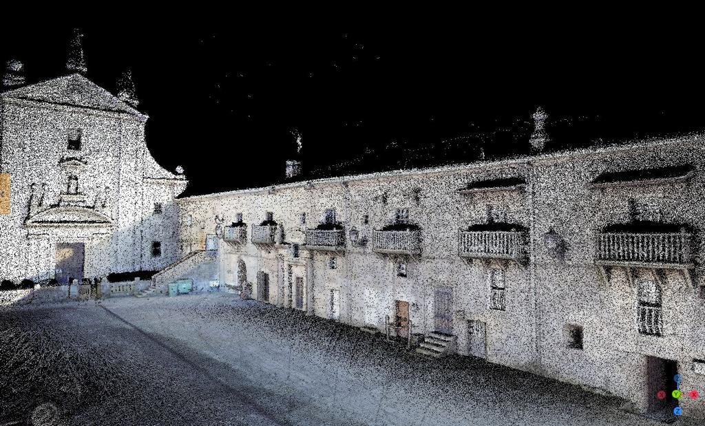
The point cloud is the basis for heritage conservation and restoration projects. This point cloud provides precise and detailed documentation of the different elements that constitute the object of study. The point cloud allows quick measurements of distances, volumes and angles between different points.
The point cloud resulting from the scan extracts data from a wide variety of file formats, such as RWP, LAS, LAZ, TZF, PLY and E57 and can be exported to different programs such as ReCap 360, REVIT or SketchUp.
With these programs you can perform multiple operations:
Specifically, in this project, the architects had great difficulty in making measurements because there are rooms in which the floor or beams are completely or partially collapsed, as can be seen in image 3.
Thanks to this technology, by “peeping” through the rooms without having to step too far, the three-dimensional model of the building is accurately obtained, and then the necessary measurements can be made from the office without posing any occupational risk.
Therefore, LiDAR technology offers multiple advantages such as:
It’s time to find an efficient and profitable solution
Contact today to experience our expertise in forest management and transform your environmental projects.